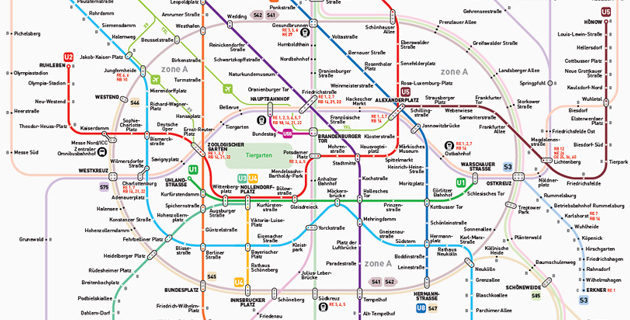
INAT is a mapping standard developed by French Serbian architect Jug Cerovic offering easy to read, easy to memorize and easy to use subway network maps.
- The crowded central area of most cities is enlarged to make room for the multiplicity of lines and connecting stations.
- A standard set of symbol is applied to all maps : line colors, stations, connections, line and station labeling.
- Line angles are gently curved for a smooth familiar look.
- All lines are represented vertical, horizontal, or 45° inclined.
- Most lines feature no more than 5 bends on their entire length.
- Highly symbolic shapes are used for specific features: Rings: circle (Moscow, Paris), rectangle (Beijing, Shanghai), stadium shaped (Berlin, Seoul), parallelogram (London) Regularly spaced straight parallel lines in gridded street pattern cities (New York, Mexico) Symmetry (Moscow) Specific shapes (Madrid)
- All text is labelled in both local and Latin characters.
- The maps are design so as to be legible on small sized prints for pocket use and suitable for display on a wide array of supports.


Don’t forget to follow Feeldesain on Twitter + Facebook to get all the latest updates.